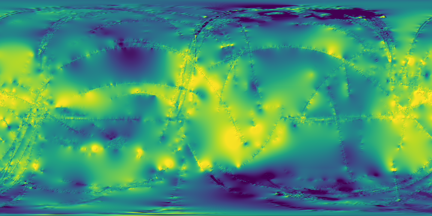
The converted samples on one map. Longitude runs from -180 to 180, positive east; latitude from -90 to 90. Toggle a layer, zoom in, and move the cursor to read where you are.
Move over the map to read coordinates
Titan global topography (Corlies et al. 2017), 4 pixels per degree: Paul Corlies (Corlies et al., 2017), Titan SARtopo Derived Digital Topography Models. Converted for this site; download links are below.
The samples
Titan global topography (Corlies et al. 2017), 4 pixels per degree
GEOGCRS["Titan (2015) - Sphere / Ocentric",DATUM["Titan (2015) - Sphere",ELLIPSOID["Titan (2015) - Sphere",2575000,0,LENGTHUNIT["metre",1]]],PRIMEM["Reference Meridian",0,ANGLEUNIT["degree",0.0174532925199433]],CS[ellipsoidal,2],AXIS["geodetic latitude (Lat)",north,ORDER[1],ANGLEUNIT["degree",0.0174532925199433]],AXIS["geodetic longitude (Lon)",east,ORDER[2],ANGLEUNIT["degree",0.0174532925199433]],ID["IAU",60600,2015],REMARK["Use mean radius as sphere radius for interoperability. Source of IAU Coordinate systems: https://doi.org/10.1007/s10569-017-9805-5"]]
GDAL reads the GeoTIFF CRS as a geographic CRS on a 2,575,000 m sphere (Titan 2015) with east-positive longitude (tools/spatial/verify.py).
GDAL reads bounds -180, -90, 180, 90 and 0.25 degree pixels, 1440 by 720.
Every elevation value is within 10 km of the reference sphere; nodata is set.
COG layout: tiled 256 by 256, DEFLATE, with internal overviews; GDAL reports LAYOUT=COG.
GDAL reads the PNG with its world file and .prj at the same bounds and CRS.
Every file listed here exists with the byte size shown.
Converted from topo_4PPD_interp.cub (and topo_4PPD.cub for the measured-only file), https://data.astro.cornell.edu/titan_topo_corlies/full_dataset/, with rasterio 1.5.2 / GDAL 3.12.2 on 2026-10-07 by tools/spatial/titan_topo.py. Data CC0 1.0, credit Paul Corlies, Corlies et al. 2017, doi:10.7298/m4dv-gv95.
The pipeline
From a data product to a GIS layer
A GIS needs to know where every pixel or line sits on the body. How much work that takes depends on what you start with.
1
A published product
An ISIS3 cube or a shapefile from the archive, with its own label describing size, resolution and projection.
2
Read the label
GDAL reads the cube's map projection and the shapefile's .prj, and writes them out on a Titan sphere of radius 2,575 km.
3
Write open formats
A Cloud-Optimized GeoTIFF, a PNG with a world file, GeoJSON and a zipped shapefile, each checked again with GDAL.
4
Open as a layer
ArcGIS Pro, QGIS or JMARS places it on the map with no guessing.
Conversion
The topography cube is already map-projected: its label says exactly which longitude and latitude each pixel covers. Turning it into a GeoTIFF is a change of file format. Nothing is estimated, so the result is as accurate as the original.
Georeferencing
A raw camera frame has no map coordinates at all. You match features in the frame to the same features on a reference map, place control points, and warp the image to fit. The result is only as good as those points, so it is approximate. See it done with one MoonKAM frame.
What each tool reads
Tool
Rasters
Vectors
Notes
ArcGIS Pro
GeoTIFF
Shapefile, GeoJSON
Uses the coordinate system embedded in the file. Keep the file's own Titan definition rather than picking an Earth one.
QGIS
GeoTIFF, ISIS3 cube (through GDAL)
Shapefile, GeoJSON
Versions built on PROJ 8.2 or later list the IAU planetary coordinate systems, Titan's among them.
JMARS
PNG or TIFF with a world file, as a custom map
Shapefile
Built for Mars and other bodies. Titan support is not confirmed.
Why the map looks flat
Web maps usually use Web Mercator, which assumes Earth and stretches the poles. This viewer uses plain longitude and latitude instead, the same plate carrée grid the samples are stored in, so what you see is the data as it is, poles included.